Just prior to the start of my third year here at Durham, I had the privilege of spending a week in Iceland as part of a glacial field skills module. The weather was (generally!) as good as we could have hoped for, allowing us to fully appreciate the magnificent glacial and volcanic landscapes of the island.
The trip was preceded by briefings at the end of our second year, giving us an introduction to Iceland’s geological history as well as some logistics (“pack plenty of waterproofs!”). We each chose group projects; for me, this meant keeping busy with plenty of geomorphic mapping over the summer!
Arrival in Iceland
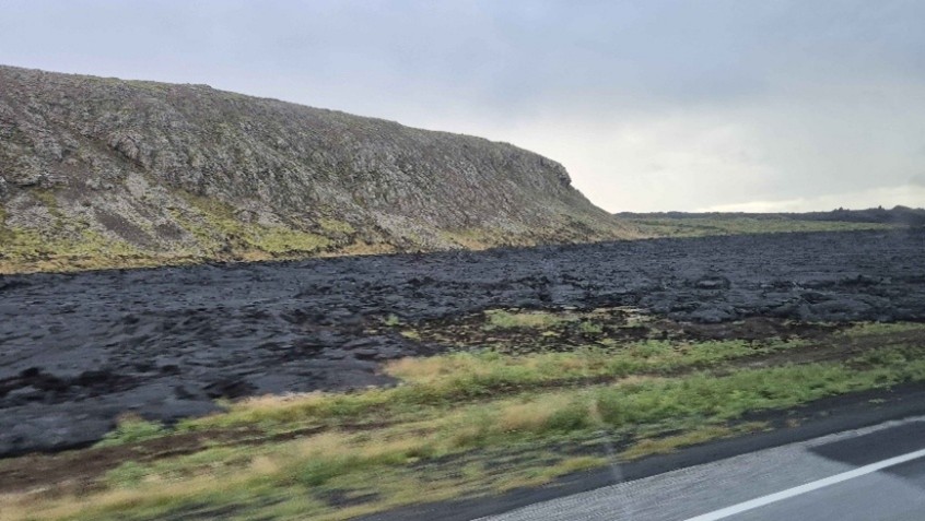
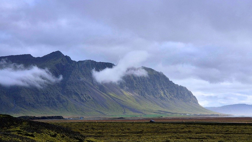
After landing, we hopped straight on the bus with our expert driver, Olafur, for a full day of travelling across the island. The contrast between the smoky lava flows of the Reykjanes peninsula in the west, and the imposing Vatnajökull ice cap in the southeast, highlighted the dynamism of the geological forces that continue to shape Iceland. In the evening, we settled into our cosy guest house, and tucked into a delicious dinner, with dessert of course!
Skálafellsjökull, the subglacial realm
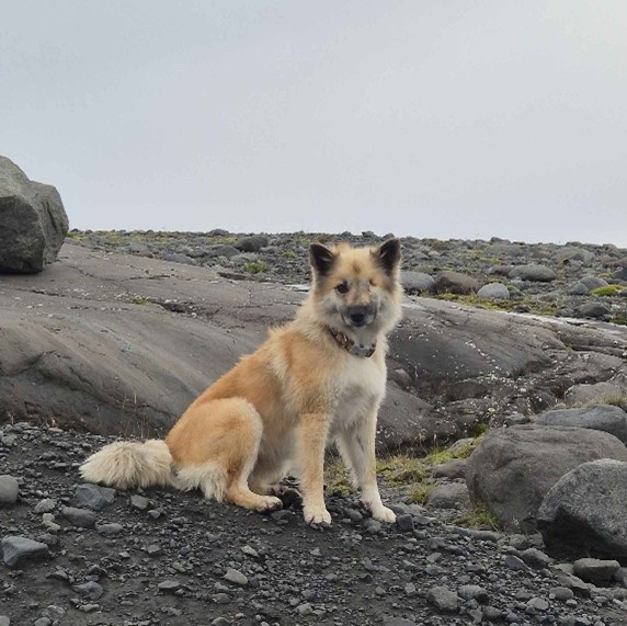
The first of two learning days was spent at Skálafellsjökull, a southern outlet glacier of Vatnajökull. Led by our professors Dave and Mike, and postgrad Holly, we explored the landforms that are produced at the bed of a glacier. From flutes to p-forms, it was fascinating to see such “textbook” landforms up-close. For most of the day, we were joined by a one-eyed farm dog called Millie, who seemed very interested in learning about subglacial landforms, even helping Dave out with some digging!
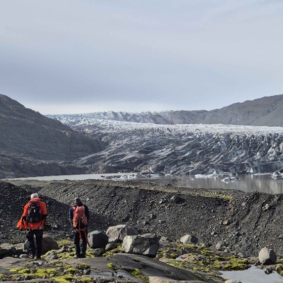
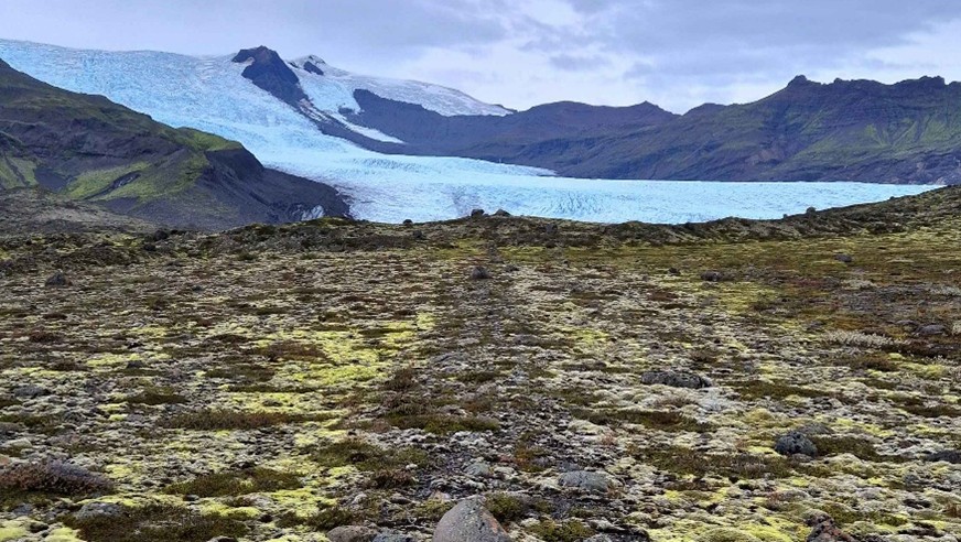
Fjallsjökull, structural glaciology and the proglacial realm
On the second learning day, we visited Fjallsjökull and Hrútájökull, two neighbouring valley glaciers. Icelandic glaciers are retreating rapidly due to climate change, something which really hit home as we walked over ground that, just decades ago, had been covered by ice.
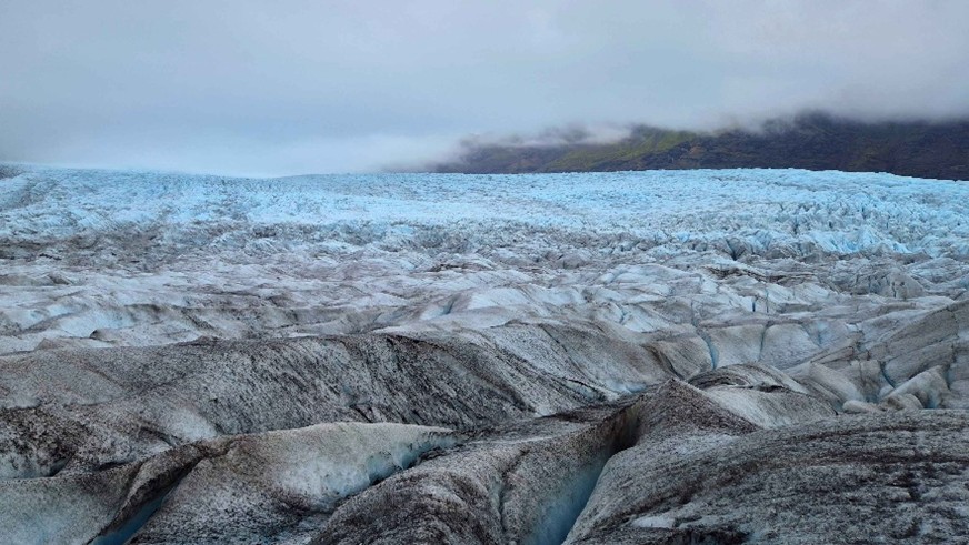
Each donning a pair of crampons, we set off for one of the highlights of the trip: a walk on a glacier! Once on the ice, Dave and Mike spoke about the intricacies of the glacier’s structure, from the menacing crevasses to the otherworldly cryoconite (small pits in the ice). We then explored the landscapes that form at the margins of a retreating glacier. While on seemingly “solid” ground, it was easy to forget that, only a few metres below our feet, was stagnating ice!
Breiðamerkurjökull, group project days
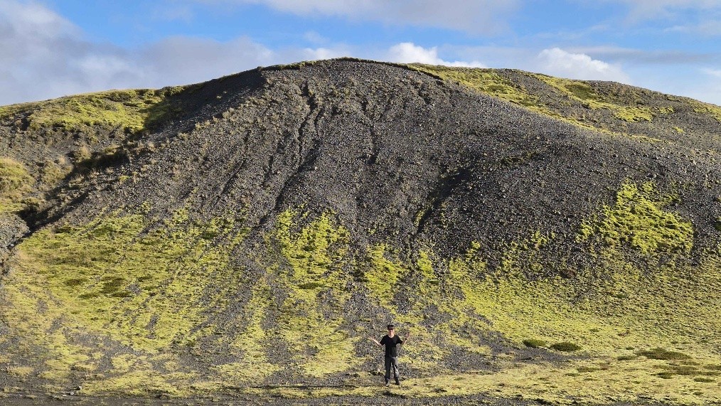
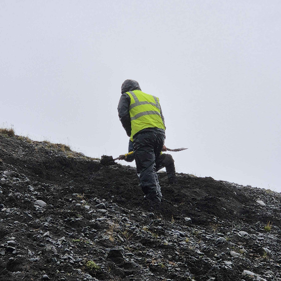
The next three days were spent on our group projects, which we had planned and prepared for throughout the summer. My group was based on the foreland of Breiðamerkurjökull, one of the largest glaciers in southeast Iceland.
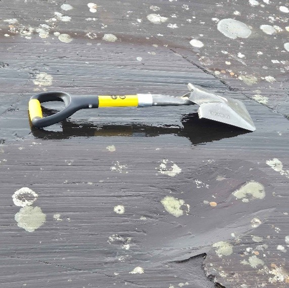
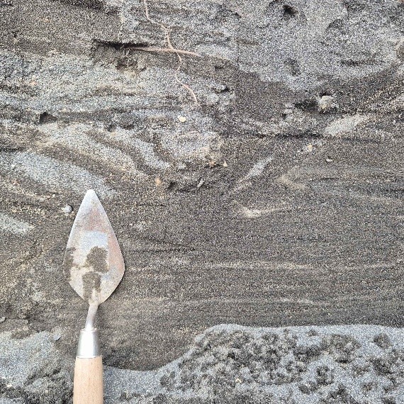
We investigated the landsystem at Breiðamerkurjökull through mapping and sedimentology, to search for evidence that the glacier had “surged”. Our main study site was an exposure into a moraine, which is a ridge of sediment that forms at the margin of a glacier. Our first day was spent digging trenches into the exposure, to uncover the sedimentary treasures within! Dave popped by to check in on our work and offer some great insights, ensuring that we felt supported. Like on most field trips, the evening was spent typing up our data and planning for the next day of fieldwork.
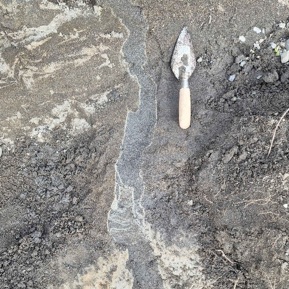
On our second project day (no doubt the rainiest!), we logged and described the sediments at our study site, finding some interesting features that recorded a change from a swamp to a glacial environment – all in the space of a few centuries! As we were working in a national park, it was important that we removed all traces of our work, so we spent a few hours filling in the exposures.
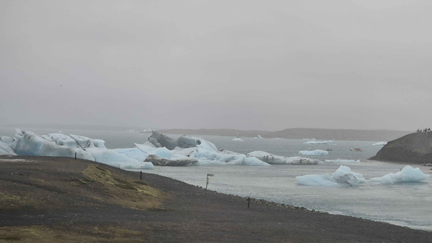
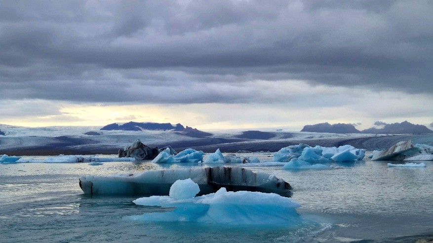
Our final project day involved walking around the foreland and investigating the landforms that we had mapped. We timed it perfectly, finishing at the famous glacial lagoon Jökulsárlón, with time for some photos and seal-watching!
Departure, and final thoughts
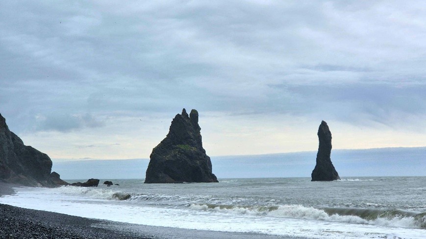
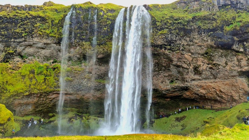
Like our first day in Iceland, the final full day was spent travelling. This time, however, the weather was much more pleasant, giving us the chance to visit some beauty spots. We stopped at the (rather infamous) Reynisfjara beach, with its magnificent columnar basalt and crashing waves, as well as the Seljalandsfoss waterfall and Seltún geothermal area. In the evening, we all congregated at an Irish bar in Keflavik for some celebratory drinks and, of course, the football!
To me, this field course has highlighted just how special fieldwork is at Durham. There’s no better way to further your understanding than by doing it in such awe-inspiring landscapes, taught by world-class teaching staff. And, while being given the independence to plan and carry out your own work is a big responsibility, there is always help on hand for when you need it!
Discover more
Feeling inspired? Take a look at our Geography Department webpages
Follow The Durham Student on Instagram, TikTok and YouTube
Create your own personalised prospectus here